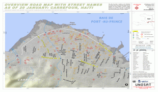
Carrefour (Carrefour)
 |
 |
Before the exile of Jean-Claude Duvalier, Carrefour was viewed as a Haitian tourist destination.
Carrefour was originally a military post in the borough of Port-au-Prince. In March 1795, Louis-Jacques Beauvais and André Rigaud defeated the English troops occupying the republican port.
The private residence of President Alexandre Petion in Carrefour has now become the home of the National School of Thor. This location holds important historical significance as it is tied to one of the founding fathers of Haiti.
On 1 May 1813, President Alexandre Pétion founded the village of Carrefour. Following a plan drawn up by surveyor Louis Rigaud, the village was to have 20 islets and 161 sites.
In 1869, the Cacos, in rebellion against the government of Sylvain Salnave, occupied Carrefour and attacked the fort of Bizoton without being able to settle there. While they were indulging in the delights of the region, Salnave lifted the Piquets of the South, who attacked them from behind and forced them to evacuate the military post. On 20 August 1889, at the height of the insurrection of the northerners against President Légitime, the vanguard of the Army of the South came to take up a position at Carrefour. The day after (21 August), the day before Légitime's departure, General Justin Carrie fought two battles and was defeated at Bizoton.
In one of his development projects, President François Denys Légitime planned to link Carrefour to Port-au-Prince by a line of steamboats along the coast to Leogane.
Carrefour was elevated to the rank of commune on 15 December 1982.
Map - Carrefour (Carrefour)
Map


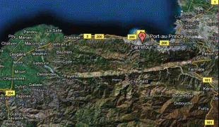


Country - Haiti
 |
 |
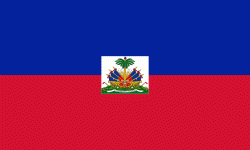
| Flag of Haiti | |
The island was originally inhabited by the indigenous Taíno people, who originated in South America. The first Europeans arrived on 5 December 1492 during the first voyage of Christopher Columbus, who initially believed he had found India or China. Columbus subsequently founded the first European settlement in the Americas, La Navidad, on what is now the northeastern coast of Haiti. The island was claimed by Spain and named La Española, forming part of the Spanish Empire until the early 17th century. However, competing claims and settlements by the French led to the western portion of the island being ceded to France in 1697, which was subsequently named Saint-Domingue. French colonists established lucrative sugarcane plantations, worked by vast numbers of slaves brought from Africa, which made the colony one of the richest in the world.
Currency / Language
| ISO | Currency | Symbol | Significant figures |
|---|---|---|---|
| HTG | Haitian gourde | G | 2 |
| USD | United States dollar | $ | 2 |
| ISO | Language |
|---|---|
| FR | French language |
| HT | Haitian Creole language |